
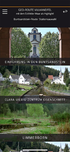
Features GeoRoute Vulkaneifel
In this first version, the "GEO-App Vulkaneifel" contains 24 of the most important geotopes / geological outcrops from the 400 million long, regional geological history and the spectacular Eifel volcanism around Manderscheid and Strohn.
There is a Devon, a Buntsandstein, a Manderscheider & Strohner volcano route.
These GEO sub-routes, which together are over 180 km long, are exclusively on local hiking trails!
Each geotope is documented with short but meaningful texts that are easy to understand: GPS data, image, geological & other information.
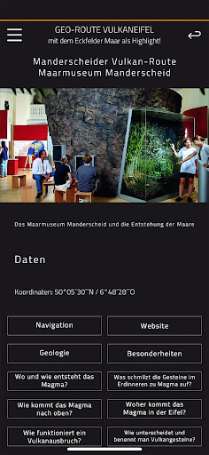
Everything is sensibly networked within the app and easy to use.
There is a more detailed outdoor GEO information board on site in the outcrop.
Further, fundamental & coherent GEO knowledge can be explored and experienced with the help of the latest, audio-visual indoor media in the Maarmuseum Manderscheid and the Vulkanhaus Strohn!
Music Features
Enjoy high-quality music streaming and playback features.
Social Features
Connect and share with friends and the community.
Fitness Tracking
Track your workouts and monitor your health metrics.
See the GeoRoute Vulkaneifel in Action
Get the App Today
Available for Android 8.0 and above